Surveying & Industrial Geomatics


PRECISE MEASUREMENTS
FOR DESIGN, CONSTRUCTION & VERIFICATION
Understand the field.
Deliver with confidence.

Surveying provides an accurate understanding of land, infrastructure and the surrounding environment.
It delivers the geometric and elevation data required to design, plan and execute projects with confidence.
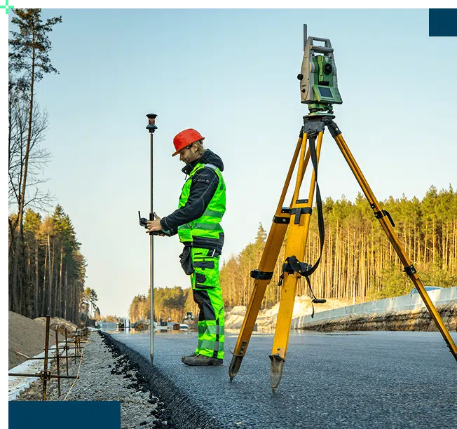
Using topographic surveys, geodetic GNSS, 3D laser scanning and drone-based acquisition, Geoliance produces accurate, reliable datasets that support engineering studies, construction works and asset management.
INDUSTRIAL GEOMATICS :
PRECISION WHERE IT MATTERS MOST
Industrial geomatics takes surveying to the next level, delivering the accuracy required in complex technical and industrial environments.
Our expertise supports:

Surveying describes the environment. Industrial geomatics ensures precise execution.
TECHNICAL EXPERTISE FOCUSED
ON MEASUREMENT AND CONTROL
Geoliance provides specialist measurement and verification services whenever precision and reliability are critical to project success.
These technical services complement, where required, land surveying activities performed by licensed surveyors responsible for legally binding property and cadastral matters.
A clear distinction
Surveying and industrial geomatics
technical measurement, positioning and geometric control
Licensed surveyors
legal property boundaries and land-related documentation
A COMPLETE AND CONTROLLED
MEASUREMENT WORKFLOW
Every project follows a structured methodology tailored to the required level of accuracy and operational constraints.
Our process includes:
- Field acquisition using GNSS, total stations and 3D scanners
- Establishment of geodetic control networks and traverses
- Geometric surveys and verification activities
- Production of operational deliverables including: Topographic plans, Longitudinal and cross-sectional profiles, Digital terrain and infrastructure models, GIS and BIM-compatible datasets
The result is structured, reliable information that can be used immediately.
Project references
Industrial geomatics for nuclear facilities
Client: ORANO (Tricastin & La Hague)
Sector: Nuclear Energy
Challenge: Produce reliable survey data for projects within existing industrial facilities.
Solution: Geodetic control networks and high-precision geomatic surveys.
Result: Updated plans supporting infrastructure positioning and project execution.

Greater accuracy and reliability
Reduce design errors and minimise execution risks.
Our services
Industrial geomatics


1. Define the requirements
Assessment of project needs, site conditions and expected accuracy levels.



TECHNICAL CAPABILITIES
Technologies
GNSS, Total stations, Digital levels, 3D laser scanners, Surveying drones
Software
AutoCAD, MicroStation, ArcGIS, QGIS
Our interventions
PROJECTION Robinson
SECURE YOUR PROJECTS
FROM THE GROUND UP

Need reliable survey data to position, verify or monitor critical infrastructure?
Geoliance combines surveying and industrial geomatics expertise to provide the precision, confidence and control your projects demand.